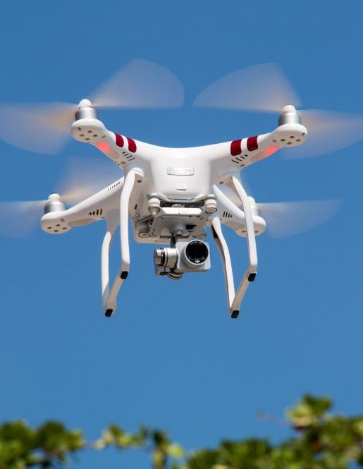
Engineering Drone Services
Engineering Drone Services by DRA provide safer and more cost-effective options for high-altitude inspections.
With our cutting-edge drone technology and qualified staff, we digitize your asset inspections, saving you time and reducing risks to your staff.
Our services have a wide range of applications in industries, including amusement device inspections, building inspections, and more.
Background of Engineering Drone Services
DRA Engineers’ can complement their consultancy services through the use of state-of-the-art cameras and technology. These devices are especially useful for recovering the positions of surface points quickly and efficiently. Orthomosaic maps, for example, help operators or responders understand a specific situation they’ll be facing and prepare themselves accordingly.
Detailed elevation models developed using digital surface model (DSM) and digital terrain models (DTM) illustrate elevations of the top of reflective surfaces accurately, such as facilities, infrastructure, landfills, and vegetation.
These high-quality maps are practical for scientific, compliance, and commercial purposes such as water and liquids management modelling, O&M, troubleshooting, and due diligence support.
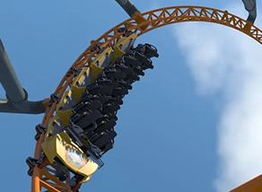
The Amusement Device Inspection
- We provide expert level inspections and risk assessments, with safety consultants who are certified by professional organizations and have experience across a range of industries. All assessments are aimed to identify potential risks and hazards then to provide solutions such as developing safety programs and conducting audits and investigations.
- These assessments are structured to identify existing hazards with the potential to cause accidents/incidents, injury, illness, environmental impact or financial loss. Our inspection process can be customised to suit the requirements of your property and specific workplace hazards. We continue to work across a range of industries including energy, retail, food processing, agriculture, construction, manufacturing and government.
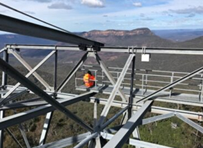
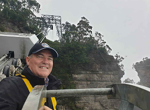
Drone inspections that reach where others can't.
Our engineering drones deliver safe, cost-effective inspections with high-resolution imagery and detailed reporting across a wide range of industries and applications.
Simple Aerial Photography For Workforce Or Infrastructure Problems
We capture high-quality aerial photography to help your team identify issues, plan projects, and document sites efficiently.3D Aerial Inspections To Assist In Future Modelling
We produce detailed 3D models using drone technology to support future planning, design, and infrastructure assessments.Provide Quality Photographs As Part Of The Assessment Process
We deliver professional photography that supports inspection reports, assessments, and documentation across all project types.Provision Of Records For Historical Use
We create and store high-quality drone imagery and data as a permanent record for compliance, planning, and future reference.
Book a Consultation Now
If you're not sure where your safety gaps are, a quick chat is usually the easiest place to start. You can talk through your site and your risks with one of our consultants, and we'll go from there.
Health and Safety Support
Our service excels with an integrated approach to amusement ride inspections, incorporating health and safety. Engineers are supported by Health and Safety Professionals knowledgeable in legislative requirements and industry standards.
- Information relating to the Inflatable Amusement Devices is discussed in one of our posts on the topic.
- Our qualified and certified RPEQ Engineering Consultants that can assist you in your business with David, Rhys, Sina, Jack, Mitchell and Ryan available to assist with any question relating to Amusement Devices.
- Information relating to the Inflatable Amusement Devices is discussed in one of our posts on the topic.

Client Testimonials
Frequently Asked Questions
Common questions about our engineering drone inspection services.What is a Safety Consultant?
A Safety Consultant is a professional qualified in the matters of health and safety in the workplace who helps businesses in ensuring they are compliant and follow the best practices in this area.
Each one of our Safety Consultants have maintained at least Certified OHS Professional certification with the Australian Institute of Health and Safety and Exemplar Global as Lead Auditors across a range of safety topics including Hazardous Chemicals and Safety Management Systems.
What does a Safety Consultant do?
Professional Safety Consultants are not restrained by the business direction placed on Safety persons in general business but are able to expand their knowledge to boarder encompass specialised knowledge and provide expert advice on what a business can do to improve the overall health and safety of their workplaces. Our Consultants have also worked in the ‘real world’ in supervisory and management positions and )more than likely) experienced what you are going through.
Who needs Safety Consulting Services?
The WHS Regulation requires a major inspection of an amusement device:
- before the end of any period for a major inspection recommended by the manufacturer of the device, or
- if a competent person who has previously completed an annual inspection or major inspection of the device recommends a shorter period than recommended by the manufacturer, the next major inspection is due by the period recommended by that competent person, or
- if there is no recommendation from the manufacturer or a competent person, the device is due for the next major inspection no later than 10 years after it was first commissioned or registered, whichever is earlier; and then no later than 10 years after its last major inspection.
While not specified in the WHS Regulation, Australian Standard AS 3533.2-2009 Amusement rides and devices Part 2: Operation and maintenance also requires a major inspection in the following circumstances:
- after a device has suffered a major departure from normal operation or a failure of any major structural or mechanical component [AS 3533.2-2009 Clause 5.4.4(d)]
- when a device is to be recommissioned and adequate records are unavailable or the device was designed and built to unknown standards. [AS 3533.2-2009 Clause 5.4.4(e)]
AS 3533 Amusement rides and devices is listed in Appendix C of the Managing risks of plant in the workplace Code of Practice as a technical standard which provides additional guidance for conducting major inspections.
What are the benefits of outsourcing WHS Services?
Outsourcing to professional workplace health and safety consultants, reduces your costs of maintaining specialised in-house staff qualified in WHS matters. Some of the key benefits to you as a business owner, are:
- Better safety and compliance – as a professional consulting firm we only employ consultants with proven track records. We do NOT pass our work on to other consultants so as to ensure we keep our reputation with our clients.
- Less stress – Consequently, having access to better advice, means you do not have to worry about health, safety and compliance matters as much, by comparison.
- Cost reduction – There are a number of overheads involved in maintaining in-house staff, especially in positions that are not always constantly required in your business.
- Outsourcing allows you to avoid those costs, by giving you access to professional consultants only when you need their help.
Why choose DRA Safety for your Safety Consulting needs?
DRA Safety has been in business for almost 30 years with a strong client base.
Over time some clients have chosen to leave for a lower price only to return due to the service and quality out put we provide.
We can assist with an initial workplace audit.
We use a range of audit tools considering the level of compliance already at an organisation. We complete the job site audit to identify and assess the health and safety matters and concerns regarding several key areas of said site (where and as applicable):
- Health and Safety Policy
- Responsibility and Accountability Statements
- Sub-Contractors and Purchasing Controls
- Health and Safety Consultation
- Risk Management
- Provision of Information
- Staff Training
- Reporting and Investigation
- Emergency Planning
- Fire Evacuation Plan
- Emergency Equipment
- Traumatic Incident Response
- Workplace Specific Issues (as relevant)
- Electrical Equipment
- Hazardous Chemicals
- Plant
- Noise
- Vehicles
- First Aid Facilities and Communicable Diseases
- Personal Protective Equipment
- Work at Height
- Ergonomic / Manual Handling
Once a suitable score is attained we generally move organisations to the National Self-Insurer OHS Audit Tool ordinarily used for organisations across Australia that self insure for workers compensation.
What types of Safety documentation can we also assist you with?
Examples of commonly encountered Safety Documents , include:
- The documentation of WHS processes, procedures, and training programs
- Documentation of identified hazards, incidents and injuries
- Documentation of internal and external health and safety management reviews
- Records of meetings concerning workplace health and safety matters
- Documentation of internal safety standards and expectations
Our Consultancy Services
We offer a range of health and safety courses, safety training and WHS consultancy services. Contact us today for an obligation free quote on any of our services.

Dra Safety
Safety Consultancy, Training, Auditing, Online Health and Safety Consulting, and Property Inspections.
Learn MoreDRA Training
Long standing RTO with Public and Private Courses including Online Training.
Learn MoreDRA Engineering
Comprehensive engineering consultancy for the amusement industry.
Learn MoreDRA Asset MGMT
Asset Management processes to manage cost, risk and performance of assets.
Learn More